American Cemetery and Memorial in GPS
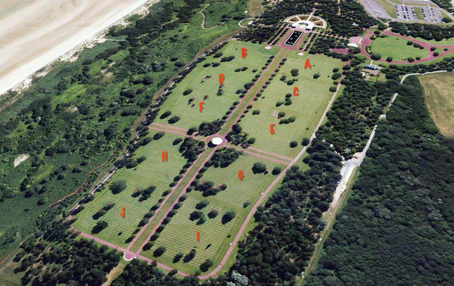
The Normandy American Cemetery and Memorial is an American military cemetery and monument in memory of the deceased American soldiers at the time of the battle of Normandy, World War II. The cemetery is divided in 10 Plots.
American Cemetery and Memorial in GPS. A project (first phase) I wanted to do for a long time, is finally finished. From here I will make other features to give everybody a more clear view of all the people, buried on this cemetery.
I have published 10624 American soldiers burried or commemorated on the wall on this cemetery by exact GPS location of their graves. So it will be possible to locate the graves in Google Map. When you visit the Cemetery and you have an internet connection it will be very easy to find the grave with your mobilephone. For practical reasons it was too difficult to plot the names, present in the Garden of missing persons on a map.
When you visit my pages with maps of the American divisions (with records and locations) you will also see the graves of the particulair division or the units who where attached to that division. You have to zoom in the area of Omaha Beach and the cemetery.
- Graves by plot: http://www.backtonormandy.org/maps/american-cemetery-normandy.html
- 10624 seperate records: https://www.backtonormandy.org/american-cemetery-graves.html
- You can always use the advanced search function: https://www.backtonormandy.org/the-history/advanced-search.html
- Count of the graves by unit: https://www.backtonormandy.org/american-cemetery/1323-american-cemetery-and-memorial-normandy-by-unit.html
- Count of the graves by state/country: https://www.backtonormandy.org/american-cemetery/1325-american-cemetery-and-memorial-normandy-states.html
- Overview and possibility for searching names, ranks, servicenumber, state, plot-row-grave, coördinates:
- https://www.backtonormandy.org/american-cemetery/1324-american-cemetery-and-memorial-normandy-names-cooerdinates.html.
Tip:
1. Go to your desired division (in this example the 29th infantry division). The first appearance will look like this.
Map with the divisions: http://www.backtonormandy.org/maps/divisions.html
2. Enter 'Colleville-sur-Mer' with a radius of 1 kilometer at the top of the map
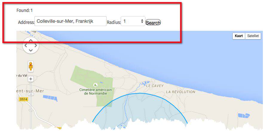

3. Draw the blue circle (with the arrow in the middle) to and over the cemetery
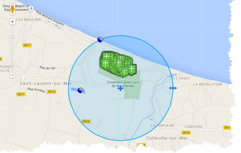
4. Zoom in the area of the cemetery
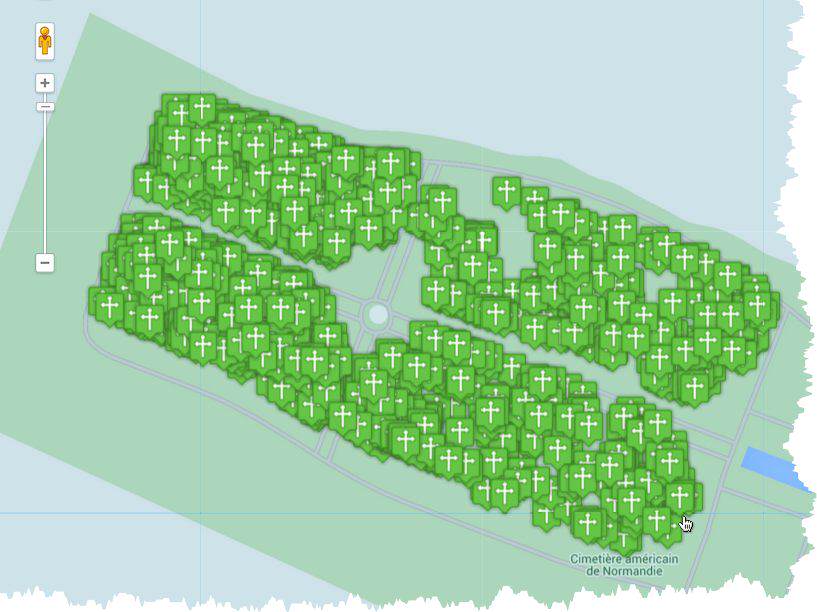
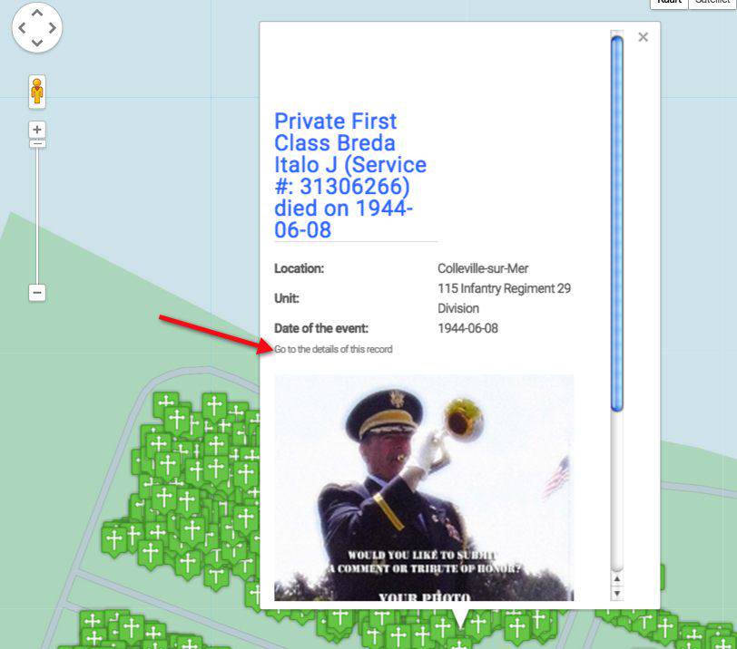
5. You can click on the marker of your choice and see who is buried there
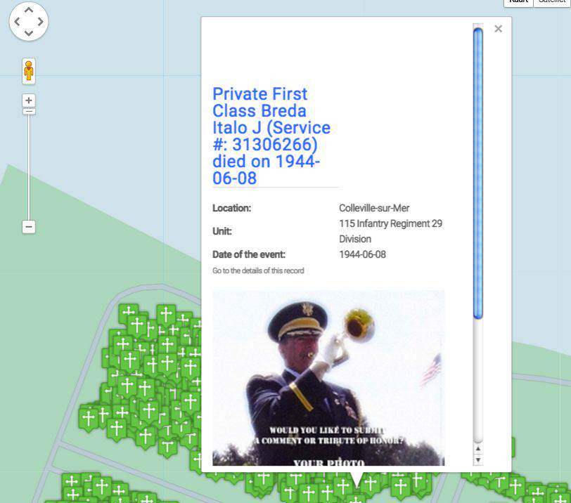
6. If you want to read more about the person, click on "Go to the details of this record"
This method of zooming and selecting will work with all the maps on Back to Normandy. For example you can use the maps by date to find out when they died: http://www.backtonormandy.org/maps/maps-1944.html
I ike to thank Lou DiLeo for the photo I could make of him on the cemetery and Teunis PATS for his great help to get all the GPS locations right on the spot!
I am looking forward to your photos, stories about these men and their units
Let me know if I can help you. Contact me by this link: http://www.backtonormandy.org/support.html